GPS navigation, GPS information and general Street Signs
This is a topic explaining the system in place for Street Names, and what defining every street in San Fierro/Whetstone can do for us. This has opened up a few opportunities so far and other ideas using our functions would be great, hop them into the suggestions. This function I have made has made quite a few things either, house names, gps navigation, admins creating street signs etc and helps players navigate places easier.
How it works?
First of all I needed all the streets defined via polygons created around each street and then the area named, thanks to @Potassium for taking time to do this. Then I built an array storing the street names and all the coordinates which took alot of time to do and I created a few functions to put the arrays to use.
Street Signs
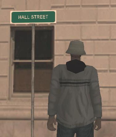
Modifying the texture of a prevous sign, adding a function to create street signs for admins /createstreetsign and my GetPlayerStreetName function I have easily been able to create signs like this:
And the street name is automaticaly found and added to the sign.
GPS
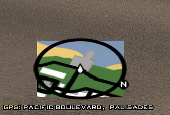
Ever used /call 911, not knowing the area well or exactly where you're out? Ever been a cop, and not known where something is or you don't have the map mod installed? This is the solution I have came up with:
I will add a nice system to find places and navigate to them, houses etc keep updated!
Oh that's so cool. Is management open to changing street names early on and or adapting them to in-character events?
Like, let's say an impactful mayor becomes elected and is loved by everyone. If it's done in character, would you be willing to script-wise change street names to reflect in-game choices? This is great all around for both sides of the role-play spectrum.
Oh that's so cool. Is management open to changing street names early on and or adapting them to in-character events?
Like, let's say an impactful mayor becomes elected and is loved by everyone. If it's done in character, would you be willing to script-wise change street names to reflect in-game choices? This is great all around for both sides of the role-play spectrum.
The signs themselves can be changed easily (I would know... I had to put them all up). I can't say how it would work script wise/internally. But I do know that the client-side map/radar mod would have to be edited for clarity and that itself is a pain.
I wonder if there'd be an efficient way to build "blocks" based on calling nearby cross streets, then you could have 100/200/300 blocks of each street, and then addresses could be based on those blocks. It probably gets harder for the non-grid parts of the city but could be interesting
I wonder if there'd be an efficient way to build "blocks" based on calling nearby cross streets, then you could have 100/200/300 blocks of each street, and then addresses could be based on those blocks. It probably gets harder for the non-grid parts of the city but could be interesting
I had this in the suggestion area but don't really know how to start or how assigning them would need to be done for easy implementation. I also had the idea of mile markers for highways which I think they mentioned doing it by meters or something so that there would be more than just the two miles or whatever. I don't know where that idea stands though